

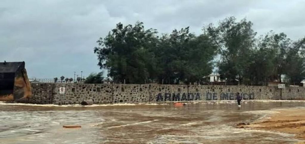
Hurricane Polo Mexico made landfall early Tuesday in Baja California, bringing powerful winds and a threat of flash flooding.
The Category 2 hurricane struck south of Las Barrancas, according to the U.S. National Hurricane Center.
Polo had maximum sustained winds of 110 mph, or 175 kph. It was moving northeast at about 13 mph, or 20 kph.
The storm had weakened slightly before reaching land. On Monday, Polo was a Category 3 hurricane with winds of up to 115 mph.
Heavy Rain and Flash Flooding Threat
Forecasters warned that Polo could produce 6 to 12 inches of rain across parts of Baja California Sur.
The heavy rainfall could trigger dangerous flash floods and mudslides.
Forecasters also warned that Hurricane Polo Mexico could affect parts of the U.S. Southwest later this week.
Arizona, Utah, New Mexico and Texas could receive several inches of rain as moisture from the storm moves north.
Andrew Mangham, a senior service hydrologist with the National Weather Service in Albuquerque, warned that the region could see rainfall arrive in a very short period.
He said dry canyons and rocky areas with limited vegetation can increase the risk of flash flooding.
Mexico Prepares for Hurricane Polo
Mexican authorities prepared coastal communities before the storm reached Baja California.
The Mexican navy deployed personnel along the northern Pacific coast. It also sent three vessels capable of delivering aid to communities isolated by the hurricane.
Local authorities prepared emergency shelters across the Baja California Peninsula.
Officials also planned travel suspensions in affected areas. Ports across the region were closed as a precaution.
In neighboring Sonora, the state government suspended nonessential activities in the capital and more than a dozen municipalities.
The suspension included schools, sporting activities and nonessential work.
Tropical Storm Rachel Tracks Along Mexico
Meanwhile, Tropical Storm Rachel was moving parallel to Mexico’s Pacific coast early Tuesday.
Rachel was located about 300 miles west-southwest of Acapulco and around 315 miles south of Manzanillo.
The storm had maximum sustained winds of 60 mph and was moving west-northwest at about 12 mph.
Forecasters continued to monitor Rachel as it moved offshore.
Hurricane Nolo Moves Away From Hawaii
Another major storm, Hurricane Nolo, was also being monitored in the Pacific.
Nolo had moved about 425 miles west-southwest of Honolulu on Monday.
The hurricane had maximum sustained winds of 120 mph and was moving north-northwest at about 15 mph.
Nolo brought heavy rain to parts of Hawaii’s Big Island over the weekend.
Hawaii National Guard members rescued 19 people from flooding, according to the U.S. National Guard.
The storm was also approaching Papahanaumokuakea Marine National Monument.
The hurricane center warned of dangerous conditions in the marine conservation area.
Pacific Hurricane Season Remains Active
The latest storms come during an unusually active period for the Pacific hurricane season.
National Weather Service lead forecaster Bob Oravec said storm activity has been above average during the peak of hurricane season.
He noted that the pattern is consistent with El Niño years, which can bring increased tropical storm and hurricane activity to the Pacific.
For Mexico, the immediate concern remains the rainfall and flooding linked to Hurricane Polo Mexico.
Authorities continue to monitor affected communities as the storm moves inland and its moisture spreads toward the southwestern United States.